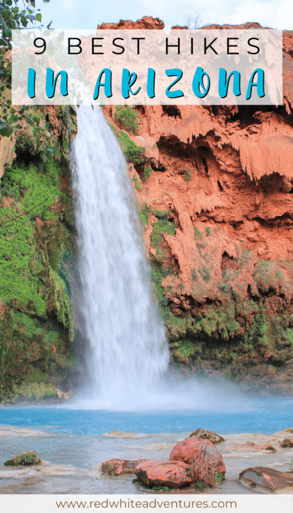
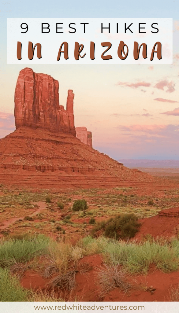
Are you looking to explore some of the best hikes in Arizona? Most people think of Arizona as a place to play golf, drink cocktails, and hang out by the pool.
What a lot of people don’t know is that Arizona has some absolutely amazing hiking!
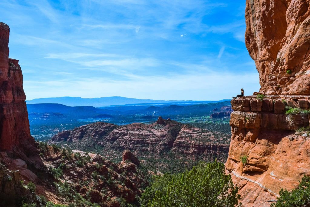
The Grand Canyon in Northern Arizona has some incredible hiking, Sedona is a magical place to explore, and even hiking in Phoenix and Tucson is super fun.

Hiking trails in Arizona are filled with the feeling of being in some wild west movie from the 70s. Every hike you go on will feel different and unique.
You’ll witness some of the craziest cacti and plants you’ll see nowhere else in the world. It truly is unique hiking in a desert and a place we never thought we’d end up hiking but we did and absolutely loved it.
In this post, we’ve put together a list of 9 amazing hikes all located within the state of Arizona. Some are near the Grand Canyon and some are in famous cities like Phoenix and Tucson. Let’s dive in!
Disclosure: this post contains affiliate links which means that if you decide to use them we get a small commission from the platform at no additional cost to you. Thank you <3
9 Amazing hikes you have to do in Arizona
Easy hikes
- “A” Mountain in Tempe
- Horseshoe Bend Hike near Bend
Moderate hikes
- South Kaibab Trail to Cedar Ridge in the Grand Canyon
- Wildcat Trail in Monument Valley
- Devil’s Bridge Trail near Sedona
- Cathedral Rocks near Sedona
Hard hikes
- Havasupai Trail to Supai
- 7 Falls in Tucson
- Camelback Mountain in Phoenix
Remember to leave no trace
When you go hiking (and do other outdoor adventure activities), always remember to follow the 7 principles of leaving no trace.
This means:
- Plan ahead and prepare.
- Travel and camp on durable surfaces.
- Dispose of waste properly.
- Leave what you find.
- Minimize campfire impacts.
- Respect wildlife.
- Be considerate of others.
Hiking Tip: Look up the trail on AllTrails before starting your hike 🗺️. You can find important trail information such as recent wildlife sights and trail closures. Check out the free version here or get a 7-day free trial of AllTrails+ here.
South Kaibab Trail to Cedar Ridge in the Grand Canyon
By Lotte from Gezond Weekmenu
Practical information about South Kaibab Trail to Cedar Ridge
Location: Grand Canyon National Park
Distance: 4.8 km return / 3 miles return
Elevation: 344 meters / 1140 feet elevation gain
Type: In and out trail
Length: 2 – 2.5 hours return (including breaks and lunch)
Difficulty: moderate (the heat in the desert is absolutely crazy)
Rating: 4 out of 5 stars
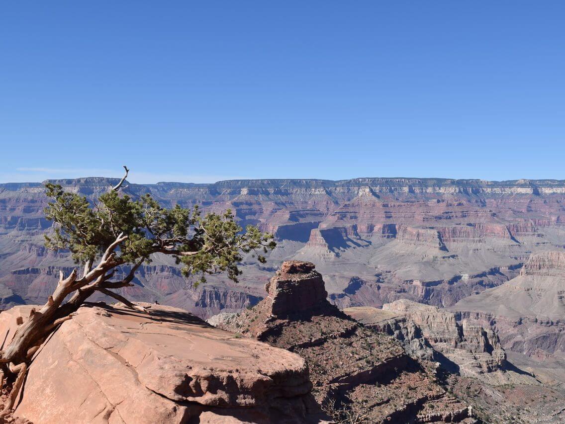
The Grand Canyon is one of the most spectacular sights in the world and one of the three national parks found in Arizona. Layered bands of red rocks, stunning views and countless hiking opportunities are just some of the highlights in this amazing National Park.
One of the best hikes in the Grand Canyon NP is the South Kaibab Trail to Cedar Ridge. The trailhead is located near Yaki Point on Yaki Point Road. There is limited parking available at the trailhead, however, unfortunately, parking there isn’t allowed because this area of the park is quite busy.
To get to the trailhead, hop on one of the hiker express buses departing from the Bright Angel Lodge and the Backcountry Information Center.
Contrary to hikes where you are climbing a mountain, during this hike, you’ll be descending first and ascending on your way back. I actually prefer it the other way around but for the South Kaibab Trail to Cedar Ridge, I gladly made an exception as it was definitely worth the effort!
From the Rim it’s 1.5 miles (2.4km) to Cedar Ridge, the difference in height is 1140 ft (348 m) and it took us 2.5 hours including a 30-minute break at Cedar Ridge. Once you’ve reached the trailhead there are a series of steep switchbacks down into the Canyon.
After the switchbacks, the trail leads to the Ooh Aah Point and down to Cedar Ridge (via more switchbacks). Allow for plenty of stops along the way to drink in the amazing views (and water breaks on the way back up, you’ll need them).
South Kaibab Trail to Cedar Ridge is a popular trail and it can get busy, especially in peak season. We hiked the trail in September during a weekday and that was perfectly fine.
Note that while it’s a relatively short hike, this isn’t an easy trail. It’s steep and there is very little shade. Be sure to wear a hat, slap on enough sun cream and bring plenty of water.
There are no facilities along the way, however, there is a restroom at the trailhead.
Horseshoe Bend Overlook near Page
By Dom and Jo from RedWhiteAdventures
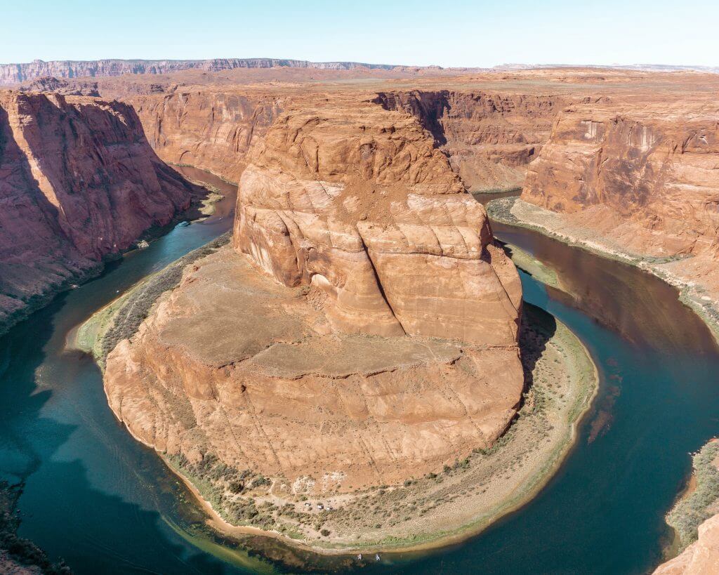
Practical information about Horseshoe Bend Overlook Hike
Distance: 2.1km return / 1.5 miles return
Elevation: 61 m / 200 ft. elevation gain
Type: Out and back
Length: 30-minute return
Difficulty: Very easy (But it can be very hot out)
Rating: 4 out of 5 stars
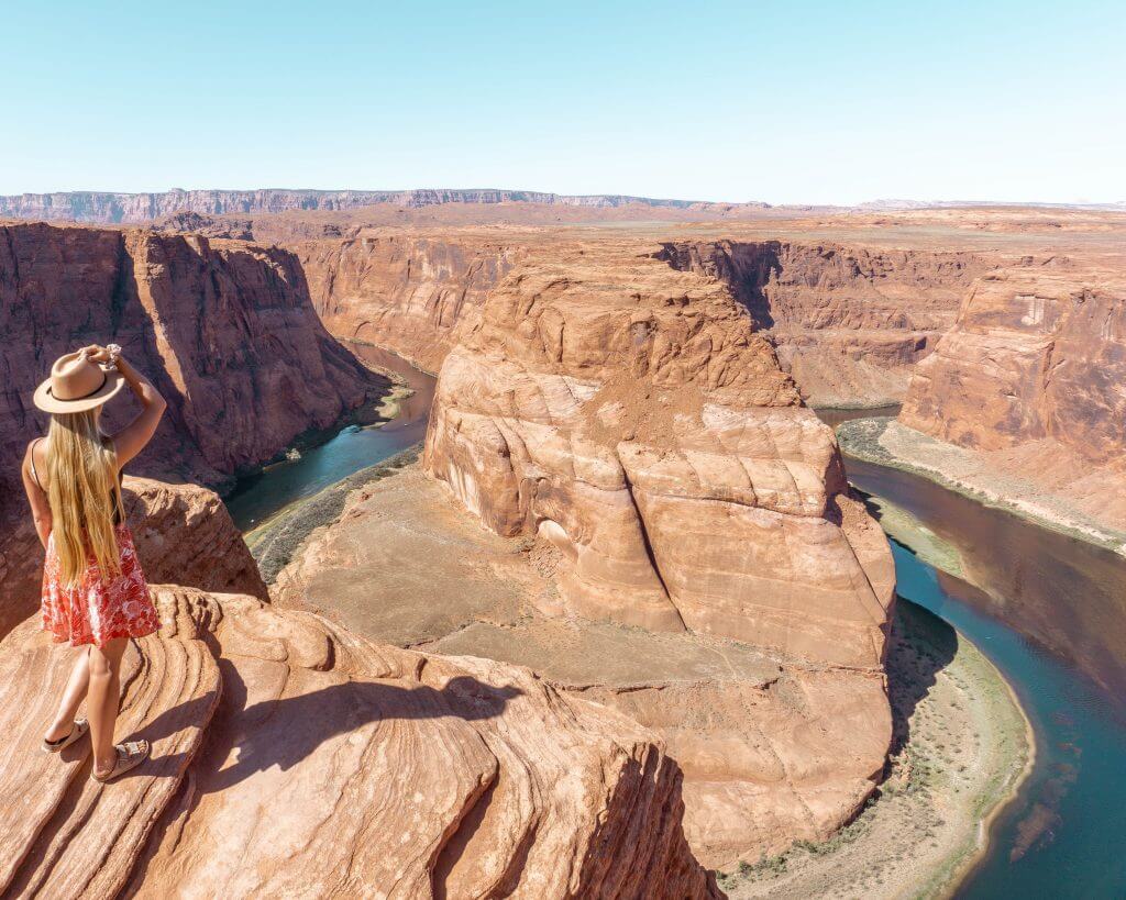
Visiting Horseshoe Bend in Page, Arizona has become way more accessible over the years. Which makes it so much easier to hike up to the Horseshoe Bend overlook.
With tourism at an all-time high, the world knows about Arizona’s beauty for more than the Grand Canyon and Hoover Dam by now, and places like Horseshoe Bend have turned into photoshoot hotspots.
The hike itself is very easy and it’s only 2.1 km (1.5 miles) from the parking lot to the overlook where the hike ends.
The path is very well maintained and there are guard rails over certain sections overlooking the bend so it is safe to bring anyone in your family.
You are not forced to stay on the path though. So you can wander off and try and find different angles to get better pictures of Horseshoe Bend but we realized that the section with the guard rails where all the tourists go is honestly the best spot.
Sticking to the path is honestly the better choice for this hike unless you want to get away from the crowds and just go explore on your own a bit. Just be careful if you do!
It’s a short hike near Page that you can’t miss. Even though it’s short and more of a trail than a hike it’s still one of those places that just blows your mind.
Consider this a short and sweet hike with an absolutely amazing view!
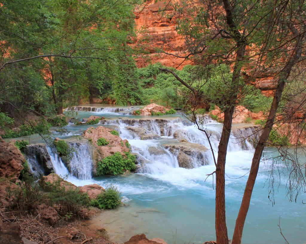
Havasupai Trail to Supai in Arizona
By Jenny from Limitlesshiker
Practical information about Havasupai Trail
Location: Supai Arizona
Distance: 24.9 km return / 15.47 miles return
Elevation: 657 meters / 2155 feet elevation gain
Type: In and out trail
Length: 12 – 14 hours (Multi-day hike, so about 6 hours each way give or take)
Difficulty: Hard
Rating: 5 out of 5 stars
Havasupai is absolutely stunning, it’s a paradise nestled in the desert. It definitely deserves a 5 rating.
Turquoise waterfalls flowing against bright red and orange canyon walls in Arizona. Havauspai sits on a Native American reservation so advance permits are required to go here, but if you’re lucky enough to get a permit, it’s worth it!
Because it is a popular hike, it is fairly crowded and attracts tourists from everywhere. However, with the permit system, it helps so it doesn’t get too crowded. If you’re looking for more solitude, start your days at sunrise!
It’s a 10-mile hike down to the first waterfall and the campground which sits right between Havasu and Mooney Falls. Backpacking is required, plus it’s more enjoyable that way! It gives you a chance to truly experience the area and the different falls.
Get an early start on the hike down from the car! There is no water or shade along the trail and it can get hot, so make sure to bring enough water and food with you to make it the full 10 miles.
The first waterfall you’ll encounter is Havasu Falls. Past this fall, are the campgrounds. Try to get a campground closer to Mooney Falls, they’re more secluded.
To get to Mooney Falls, you’ll need to hike past the campground and down some stairs.
Once you’re down to Mooney Falls, you can keep going further down the canyon to Beaver Falls which is 6 miles round trip from the campground.
If you’re feeling adventurous, you can also keep hiking to the Confluence which is where Havasu Creek meets the Colorado River, this is a 16-mile round trip hike.
For more information on Havasupai, when to go and how to get permits, read through this blog post.
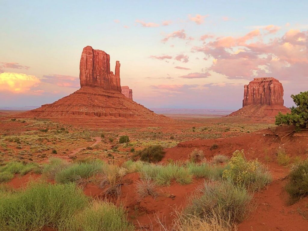
Wildcat Trail in Monument Valley
By James from ParksCollecting
Practical information about Wildcat Trail
Location: Monument Valley, Arizona
Distance: 5.8 km return / 3.6 miles return
Elevation: 118 meters / 380 feet elevation gain
Type: lollipop / lasso
Length: 2 – 3 hours
Difficulty: Easy to moderate
Rating: 5 out of 5 stars
The Wildcat Trail is the only hike in Monument Valley that you can do without a guide. Monument Valley is on Navajo land and is technically called the Monument Valley Navajo Tribal Park.
Consequently, most of the valley requires a Navajo guide, except for this one trail. The trail is a great opportunity to venture out into the desert and see one of the most famous buttes up close and personal.
The trail is a lasso shape, with a short out-and-back trail at the start/ finish, but most of the trail is a loop around West Mitten.
The first (and last) 0.5 mile is a descent/ ascent in soft sand, which means that last part is the hardest. However, the rest of the trail is hard-packed dirt and not especially strenuous. It is also easy to follow.
The trail takes about two hours without stops, but could take up to three if you really take your time.
It is closed in the hot months between the hours of 11:00am and 5:00pm because the heat during the day is dangerous. However, early morning and late afternoon are the best times to go anyway, as sunrises and sunsets are spectacular.
The last rays of the sun especially turn West Mitten a molten red color. The area has a high elevation, so it does snow in winter.
This hike for me was a very clear 5/5. The scenery is stunning.
There are panoramic views of Monument Valley, but also close and ever-changing views of West Mitten, East Mitten and Merrick Butte as you circle around the back of the West Mitten butte. Plus, it gives you a chance to pay close attention to the desert flora and even smell the sagebrush.
Considering how famous Monument Valley is, and how this is the only non-guided trail there, it is surprisingly empty. I hiked it the first week in September at 6:00pm and saw one other couple the entire time.
I highly recommend hiking the Wildcat Trail when you visit Monument Valley. It’s one of the best hiking trails in Arizona in my opinion.
“A” Mountain in Tempe
By Constance from TheAdventuresofPandaBear

Practical information about “A” Mountain
Location: Tempe, Arizona
Distance: 1.5 km return / 0.93 miles return
Elevation: 71 meters / 232 feet elevation gain
Type: In and out
Length: 45 minutes to 1 hour
Difficulty: Easy
Rating: 4 out of 5 stars
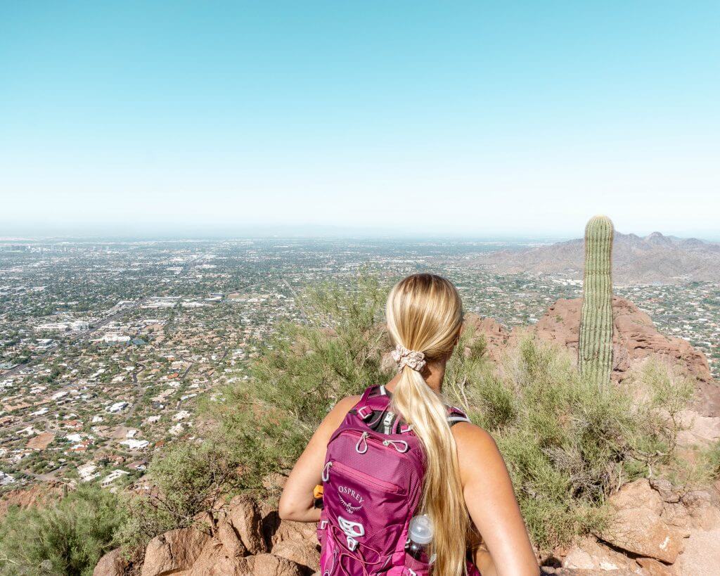
“A” Mountain is one of the most fun things to do in Tempe, Arizona. Not only is this hike quick, but it is also insanely rewarding. It’s the highest point in Tempe at 1,495 feet tall, it is known by several names, including Hayden Butte, Tempe Butte, and “A” Mountain.
It is locally known as “A” Mountain due to its 60-foot tall golden yellow letter “A” painted on its side for the city’s Arizona State University (ASU).
The hike up “A” Mountain is only approximately 1 mile out and back with an elevation gain of 230 feet. The trail can be easily completed in approximately an hour or so, depending on how long you decide to take in the view.
Though the hike initially looks a bit steep, the trail is mostly paved making it easy and accessible to most up until the first viewing area. After that initial viewpoint, it is primarily composed of stairs and switchbacks that take you up to the top of the mountain.
The views alone make this hike a perfect 5 in my books. With nearly 360 views at the top, you get an amazing sky-high view of the city of Tempe and Papago Park.
At the hill’s summit, you’re also along a flight path so you’ll catch many airplanes landing and taking off.
The hike can be busy but since it is off the beaten path, it is primarily composed of locals wanting to get a quick hike into their day. Most people start early before the weather gets too warm or later in the day to get a great sunset view.
As with any desert hike, you’ll potentially spot flora and fauna such as cacti, wildflowers, and gopher snakes.
Be sure to also keep your eyes peeled for ancient Native American petroglyphs carved into “A” Mountain’s volcanic stone.
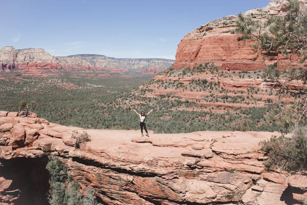
Devil’s Bridge Trail near Sedona
By Kelsey from SightsBetterSeen
Practical information about Devil’s Bridge Trail
Location: Sedona, Arizona
Distance: 6.8 km return / 4.22 miles return
Elevation: 172 meters / 564 feet elevation gain
Type: In and out
Length: 2.5 – 3.5 hours return
Difficulty: Moderate
Rating: 5 out of 5 stars
The Devil’s Bridge hike in Sedona, Arizona is absolutely gorgeous, and one of the best things to do in Arizona. Towering red cliffs and bright green cacti cut into the neverending sky.
It’s thrilling, too – although the bridge is wider than it looks in the picture (5 feet), you’re still 54 feet above the ground, standing on the biggest sandstone arch in Sedona. There’s even the possibility of energy vortexes along the way!
The hike isn’t too difficult at just 1.8 miles round trip with a 400-foot climb. However, to park right at the trailhead you need a 4×4 vehicle.
If you don’t have one, you’ll have to park a little further away at the main parking lot off of Vultee Arch Rd or at the Mescal Trailhead, which will make it about 4 miles total.
We did the latter option for a longer hike, and it took us about 3 hours, mainly because we also stopped for lunch and waited to take our photos.
The actual hike is pretty easy for the first mile with a semi-vertical rock scramble near the end. About ¾ of the way in, the trail divides into two: one heads up to the top of the arch, and the other to the bottom.
It can be a little steep in the last mile if you choose to hike to the top, so I wouldn’t recommend it for little kids.
Prepare to stand in a line (yep, what you don’t see is a line of people waiting to get their photo taken) and if you’d like to come during less crowded hours I’d suggest going before 9AM or after 5PM.
Also keep in mind that Sedona can get really hot in the summer, so you may either avoid hiking at midday or visiting during fall or spring instead (it sometimes snows in the winter).
Remember to also check the forecast for thunderstorms (also mostly in summer) – although the landscape does look epic with huge clouds looming above it, the weather can change pretty quickly so just be aware.
Overall, I’d honestly rate this hike a 5! It was exciting being so high up on the bridge, Sedona is stunning and one of my favorite places, and it was pretty easy. Only reason I’d rate it less would be due to the possibility of crowds, but again, you can avoid that by going during off peak hours.
Cathedral Rock in Sedona
By Jeanine of LeWildExplorer
Practical information about Cathedral Rock Trail
Location: Sedona, Arizona
Distance: 2.5 km return / 1.55 miles return
Elevation: 268 meters / 879 feet elevation gain
Type: In and out
Length: 30 minutes to 1 hour return
Difficulty: Moderate
Rating: 4 out of 5 stars
The Cathedral Rock trail is a stunning hike in Sedona with sweeping views of the red rock formations and evergreen vegetation that are iconic to the city.
The hike is quite popular and heavily trafficked but still one of the best hikes in Sedona in my opinion for a few reasons.
Sedona is a beautiful city with so much natural beauty. The best way to enjoy visiting the city is to take in one of the memorable hikes in the area.
Cathedral Rock is quite short of a trail at only 1.2 miles but can present some hikers with a bit of a challenge since it’s all uphill.
The Arizona sun is strong so take water when doing this hike. It’s also wise to wear hiking boots or shoes with a good grip to prevent slipping when descending back down the trail.
A few people had hiking poles but they’re definitely not necessary on this trail.
Once at the top, you’ll be rewarded with a beautiful view. Be sure to take a camera to capture the landscape.
If you’re feeling adventurous you can walk passed the “end of trail” sign to the right and take the narrow pathway, which is about four feet wide to get a photo of yourself standing on what appears to be a ledge. It’s a short walk and the pathway opens up.
Do be careful and do this at your own risk, it is dangerous.
If you’re looking for an epic hike in Sedona but don’t have much time definitely add Cathedral Rock to your list. I give this hike a 4/5 rating, because of the scenic view at the end.
I wish there was more to see along the way but the trail is so short that the end makes up for it. Enjoy hiking in Sedona.
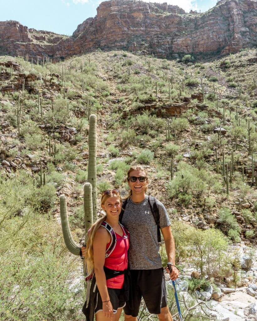
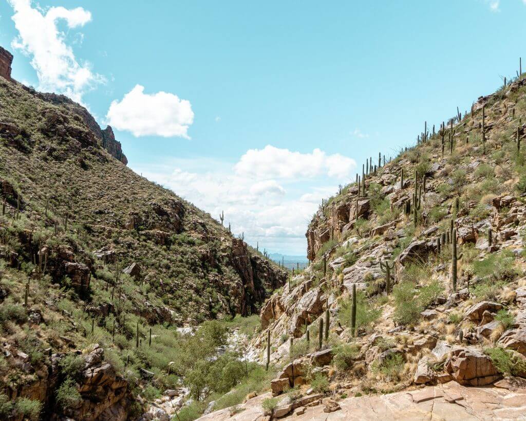
7 Falls Waterfall Hike in Tucson
By Dom from RedWhiteAdventures
Practical information about 7 Falls
Distance: First option is 7.9 km return / 4.8 miles return, the second option is 13.7 km return / 8.5 miles return
Elevation: 324 m / 1062 ft. elevation gain
Type: Out and back
Length: First option is about 2.5-3 hours, the second option is about 4 hours return
Difficulty: First option is moderate, the second option is hard
Rating: 4.5 out of 5 stars
You’re probably thinking: How on earth is there a waterfall in the middle of the Arizona desert? We’re not sure, but it’s there! If you are looking for a fun day hike where you can see a beautiful waterfall then 7 Falls in Tucson, Arizona is the hike for you!
Be prepared to start early in the morning to avoid the head and to bring a lot of water! Or go in winter. You’re exposed to the sun during the whole hike like on this one so you definitely don’t want to start mid-day in the summer.
We were visiting a close friend right in the middle of summer so we had no other choice besides starting early in the morning.
Yes, there is a waterfall and a pool that you can swim in at the end of the hike once you get there. But you have to make sure you can get there first so come prepared!
Hiking poles were also amazing for this hike. Since you’re hiking in Arizona, there is a risk of running into scorpions or snakes along the way, and hiking poles work well as a ‘protector tool’ to have in case that happens.
Besides that, the hike is relatively relaxed and easy. One of the special things about Seven Falls though is the amount of Saguaro cacti you will see along the trail.
Did you know that Saguaro cacti can only be found in Arizona, Mexico, and California? It’s true – and they’re massive!
This just makes it even cooler to go on a hike in this area because you’ll be surrounded by them. They make for some amazing backdrops in your photos too.
So enjoy taking pictures of the cacti and the pool at the end where you can relax before hiking back to your car.
So enjoy hiking Seven Falls in Tucson and any other questions you may have on the hike might be answered in this post.
Also read: 4 of the Most Beautiful Waterfalls in Arizona
Camelback Mountain in Phoenix
By Jo from RedWhiteAdventures
Practical information about Camelback Mountain
Distance: 7.7 km return / 4.8 miles return
Elevation: 798 m / 2618 ft. elevation gain
Type: Out and back
Length: 2-3 hours return
Difficulty: Hard (because of the heat and elevation)
Rating: 4.5 out of 5 stars
Firstly, we want to thank our good friend Anna for showing us this hike. She let us crash at her place for a few nights during our US road trip.
Camelback is right in Scottsdale and stands out from a ways away. It truly does look like the back of a camel so the name is very fitting haha.
It’s quite a fun hike since you’re basically in the middle of the city with neighbourhoods surrounding you on all sides. You sort of feel like you’re on top of the world because the desert is so flat and all you see is smaller hills all over the place.
It’s very different from hiking we’re used to in the Canadian Rockies but it was magical in its own way.
Even though it was super hot we were covered by shade for the first portion of the hike and then once we got to the top it was burning but we luckily started early enough to beat the mid-afternoon heat.
There are also water fountains at the trailhead so you can fill up your bottle before and after the hike which was fantastic.
It’s definitely a hard hike because there is quite a bit of elevation. It’s challenging enough that the hike makes you work for the view but also very manageable.
They’ve put some railings and stuff up over the years to make the hike more friendly for the regular hiker.
So go enjoy a day of hiking in Phoenix and take in the amazing views from the top of this anthill, haha! Here is all the extra information you may need on Camelback Mountain.
You may also like…
- 12 Epic Things to Do in Page Arizona
- A Full Day Trip From Flagstaff to Grand Canyon
- Horseshoe Bend Hiking Trail: A Beginner’s Guide
- 4 of the Most Beautiful Waterfalls in Arizona
- The Best Campground at Lake Powell – Wahweap Campground
Recap all the best hikes in Arizona
There you have it. Our list has incorporated some of the best hikes in Arizona including some from urban places like Phoenix all the way to the Grand Canyon. Even a few from Sedona which people say has the best hiking trails in Arizona.
Arizona is an incredible place to go hiking and explore. Even though it’s a desert and you’d expect it to be flat it has some awesome hikes with beautiful arches, rock formations, and much more!
One thing to note is that for a lot of these hikes, you will need to get an America The Beautiful Pass. If you don’t have one already, you can buy it through REI here.
If there’s one last thing we share again is that Arizona gets extremely hot especially March through October. This is when the majority of us usually travel so just be prepared for the heat and bring lots of water, sunscreen, and proper clothes.
If you’re lucky and can travel off-season then that would be the best time to visit.
Otherwise, enjoy the great state of Arizona and let us know which hike you enjoyed the most or if there’s any that deserves to be on the list. We’d love to hear from you!
Love it? Share it!