It’s been an absolute privilege growing up near the Canadian Rockies. That drive from Calgary towards Canmore and Banff may be one of the most beautiful drives in the world.
With so much to explore and so much to see in Kananaskis, we want to share 6 hikes in Kananaskis that you must do if you’re travelling the area or live close by.
These are 6 hikes that we’ve personally done and absolutely recommend!
In this post, we will share the length and difficulty of each of these hiking trails in Kananaskis to give you an idea of what they’re like and which ones you want to conquer first.
All of these hikes range in difficulty and some are easier than others but, in our opinion, they are all some of the best hikes in Alberta.
One of them is even the easiest summit hike in Kananaskis which offers awesome views of the Bow Valley Provincial Park!
Kananaskis Country is the perfect place to hike because there are tons of trails just off the highway, not too far from Calgary. Wasootch Ridge and Yates Mountain are just a few examples.
Even if you’re driving between Banff and Calgary then there are plenty of great hikes right off the Kananaskis turnoff. There’s a reason why we always love spending weekends out here and hopefully you will too!
There’s an abundance of hiking in the area and sometimes it’s hard to figure out where to start first. With this post, at least you’ll have a list of a few great hikes to consider 😉
6 hikes in Kananaskis that will put a smile on your face
Hiking Tip: Look up the trail on AllTrails before starting your hike 🗺️. You can find important trail information such as recent wildlife sights and trail closures. Check out the free version here or get a 7-day free trial of AllTrails+ here.
#1 Chester Lake Trail Trail
Practical information about Chester Lake Trail
Distance: 9.2 km return / 5.7 miles return
Elevation: 300 m / 1000 ft. elevation gain
Type: Out and back
Length: 2-3 hours return
Difficulty: Easy
Rating: 4 out of 5 stars
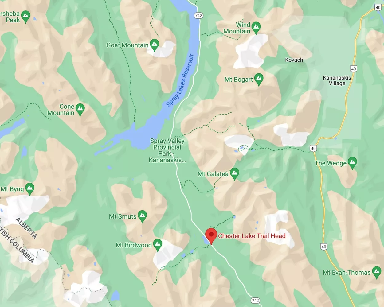
Here’s a map of the Chester Lake trailhead
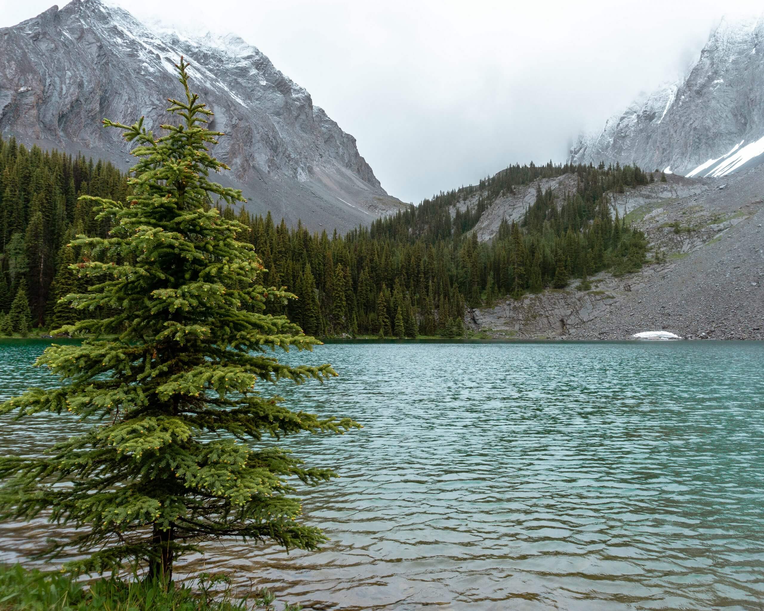
Are you looking for an easy day hike near Canmore with a gorgeous lake? Then add Chester Lake Trail to your list of places to visit in Canada’s Rockies. Chester Lake Trail has an alpine lake and a waterfall!
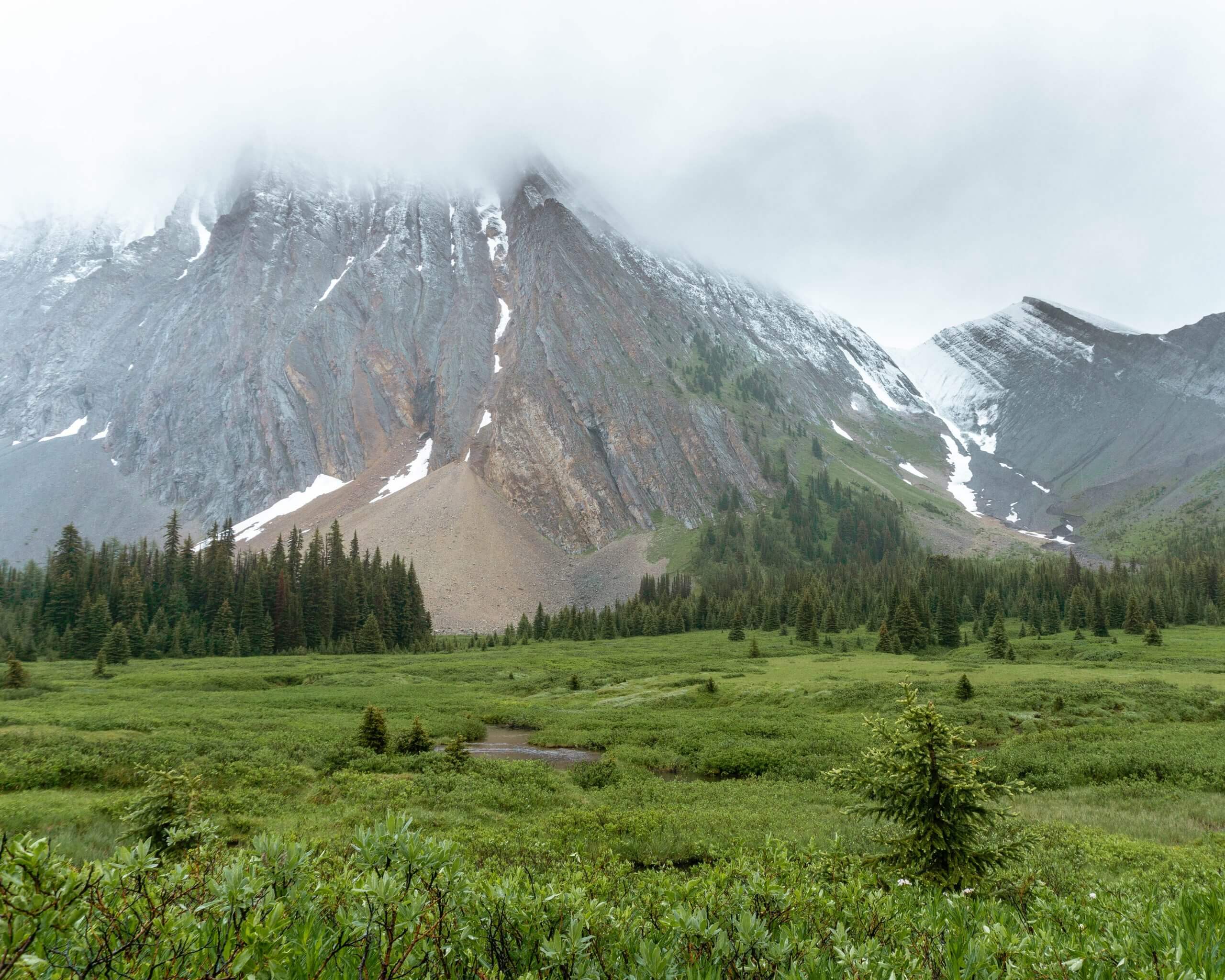
Located in Spray Valley Provincial Park near Kananaskis, this beautiful and easy hiking trail takes you through the forest and onto an alpine meadow by Mt Chester.
This is the perfect trail if you’re looking for something not too difficult and not too long. But it still comes with a view worth hiking up to.
The alpine lake that you will find up in the meadow makes this hike stand out compared to some others.
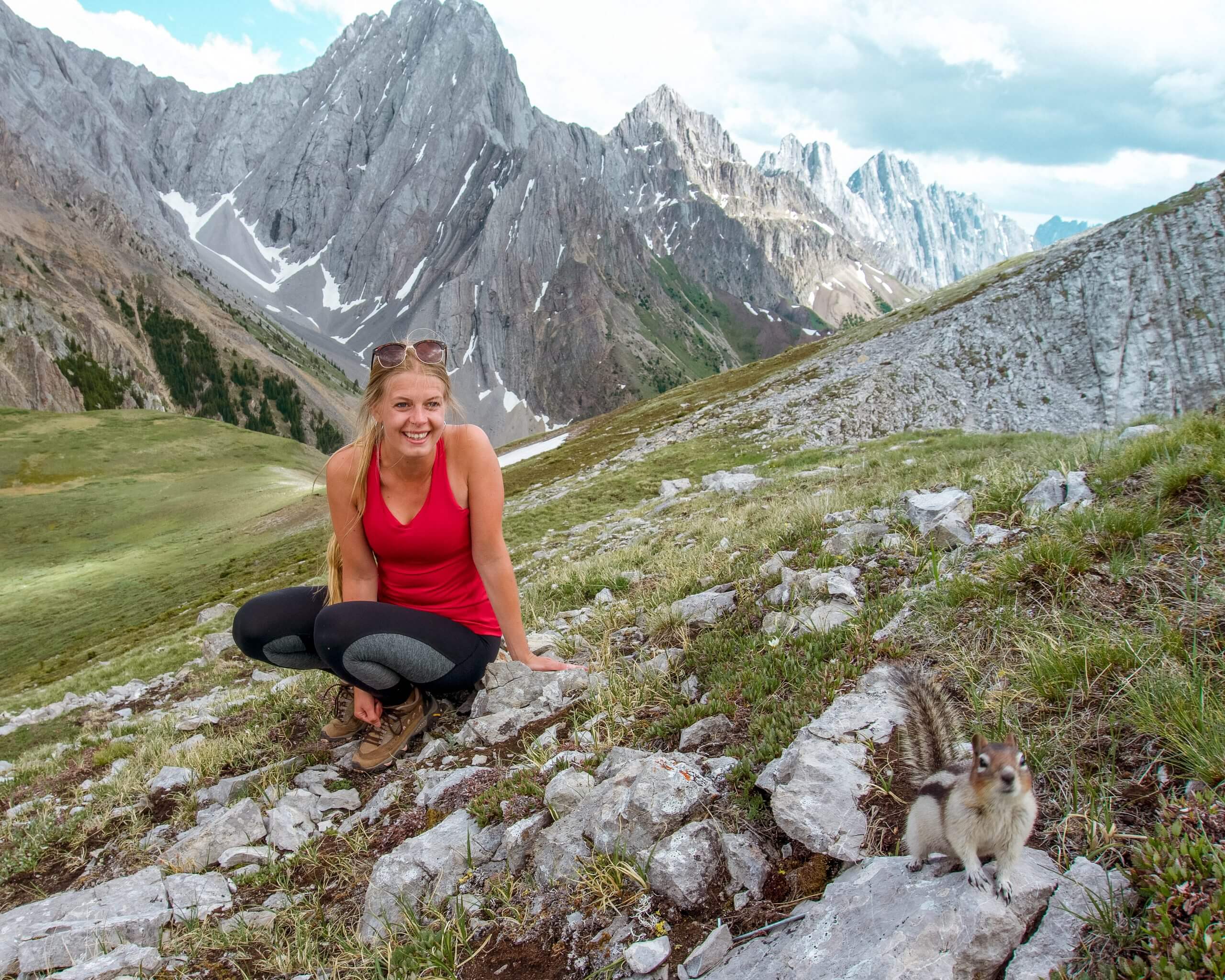
The lake is the goal for this hike and once you get there you’ll have a perfect place for a picnic. We spent some time taking photos of Chester Lake and the mountains surrounding it.
For being a fairly moderate hike you are rewarded with some amazing views.
We also discussed how we’re going to climb up to the summit of Chester Lake Mountain one day. That’s also something you can look into if you’re an advanced hiker.
If you wish to make this hike longer, you can walk around the lake. Once you get behind it you’ll be able to spot a stunning waterfall.
Be careful though as bears have been spotted in this area quite frequently (this was the reason we didn’t go).
Kananaskis trails are known for bear sightings, so just keep a lookout for them.
Spray Valley Provincial Park, in particular, is known for bear sightings on many of its well-known hikes. So check in advance before heading out on the trail.
Here are all the advisories associated with Spray Valley Provincial Park.
If you do end up hiking Chester Lake Trail then it’s just over an hour from Canmore to get there. A very easy drive if you’re looking for a hike to do near Canmore.
Even though we didn’t have a 4×4 we’d recommend one because the gravel road going to Chester Lake isn’t in the greatest condition.
It’s doable but the drive will be much quicker and more comfortable to the trailhead and back into town if you have a vehicle that doesn’t mind potholes.
Also read: The Full Guide to Hiking Chester Lake Trail, Kananaskis
#2 Wasootch Ridge
Practical information about the Wasootch Ridge
Distance: 15.4 km return / 9.56 miles return
Elevation: 1451 m / 4761 ft. elevation gain
Type: Out and back
Length: 4.5-6.5 hours return to the furthest peak.
Difficulty: Moderate up until the cairn, then the scramble to the summit is difficult.
Rating: 4.5 out of 5 stars
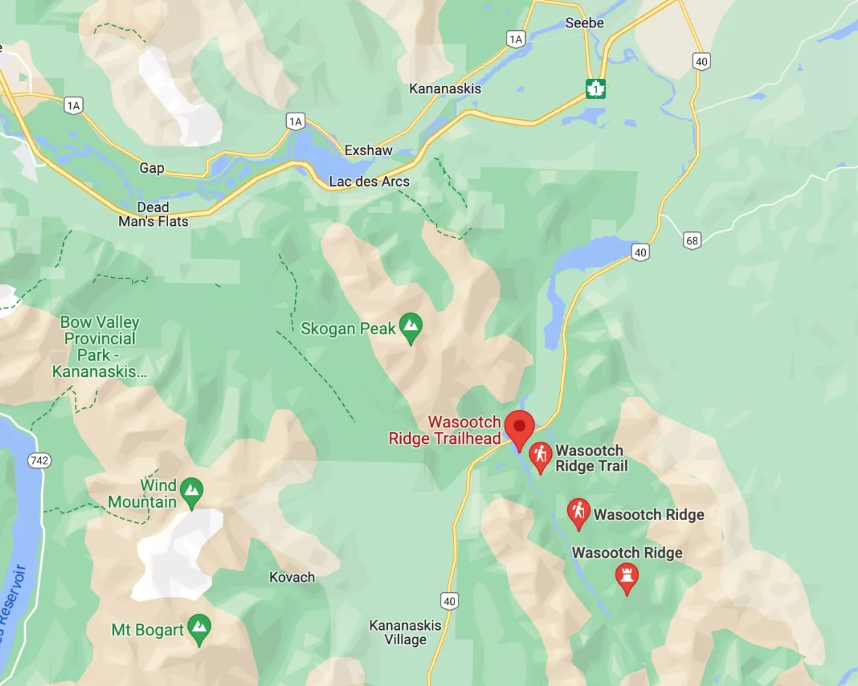
Here’s a map of the Wasootch Ridge trailhead
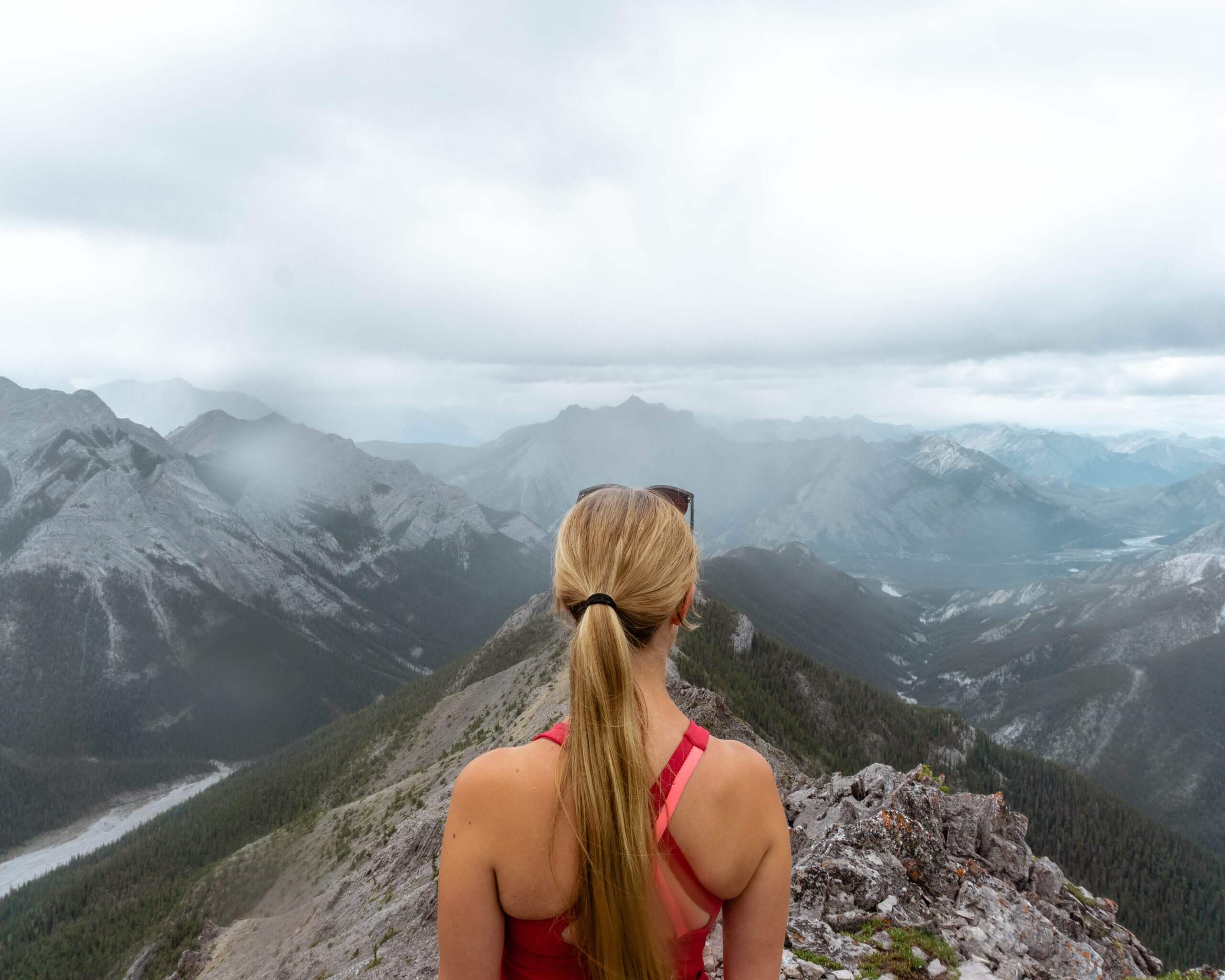
Wasootch is quite a challenging day hike in Kananaskis but very rewarding.
From the outskirts of Calgary, you can get to the Wasootch Ridge parking lot in just under an hour and get your hike started right away.
With a lot of incline in the first kilometre, you’ll already be seeing amazing views after the first half hour. Really… Wasootch Ridge gives you stunning views of Kananaskis.
It is an in-and-out hike. Most hikes in Kananaskis are in and out, so this one is no different in that sense.
The steep incline from the beginning reminds us of Vision Quest near Nordegg (one of our favourite hikes in Alberta).
Once you get past the first bit of incline on Wasootch you start to walk along the ridges for the rest of the hike. It is still steep and challenging but you’ll have views for days!
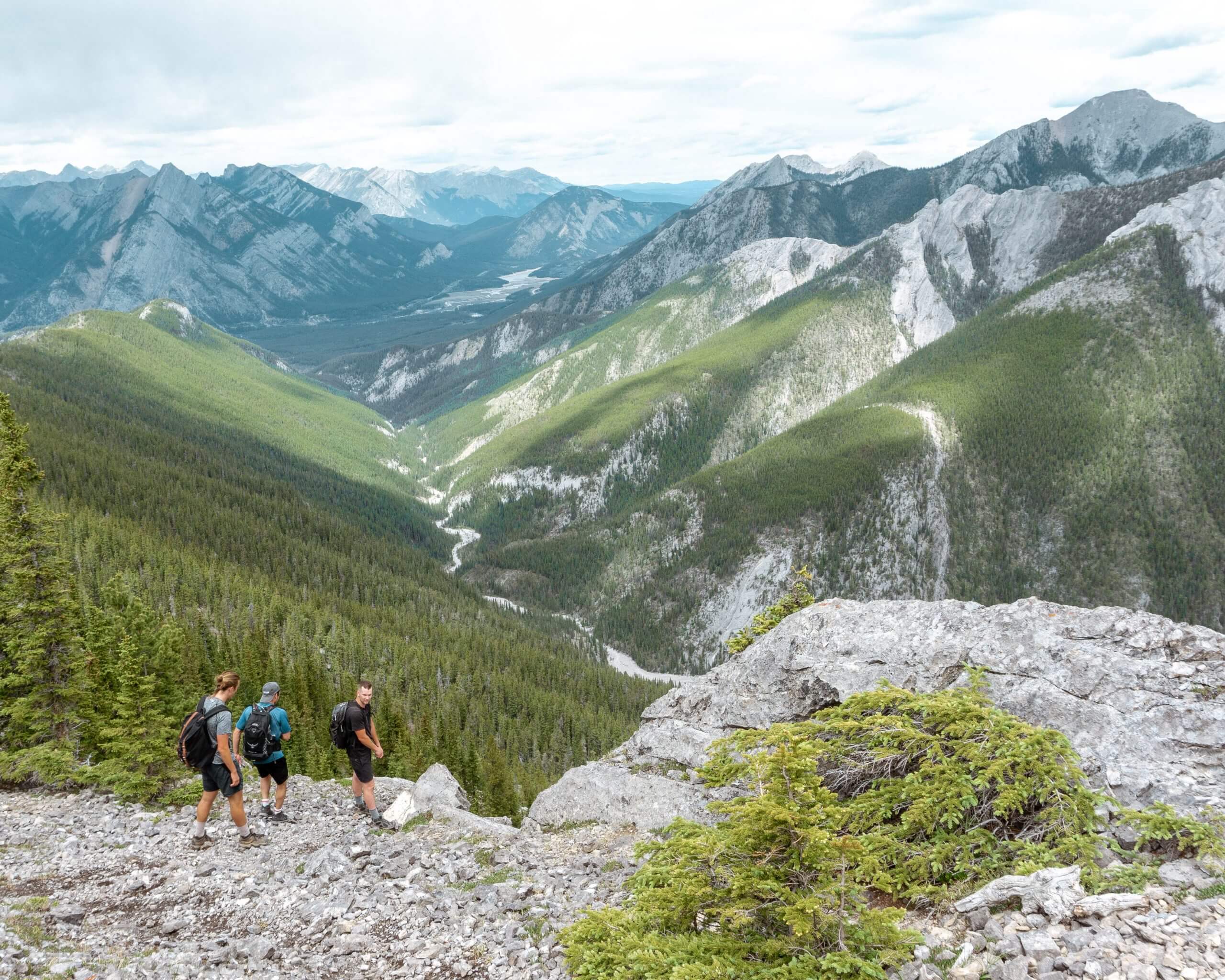
One thing that really stands out on Wasootch is how quickly you get out of the trees and just get to experience the views.
Most hikes tend to be in the forest for the majority of the trail and then open up near the summit. But Wasootch is the opposite. You’re in the bush for the first half hour and after that it’s completely open.
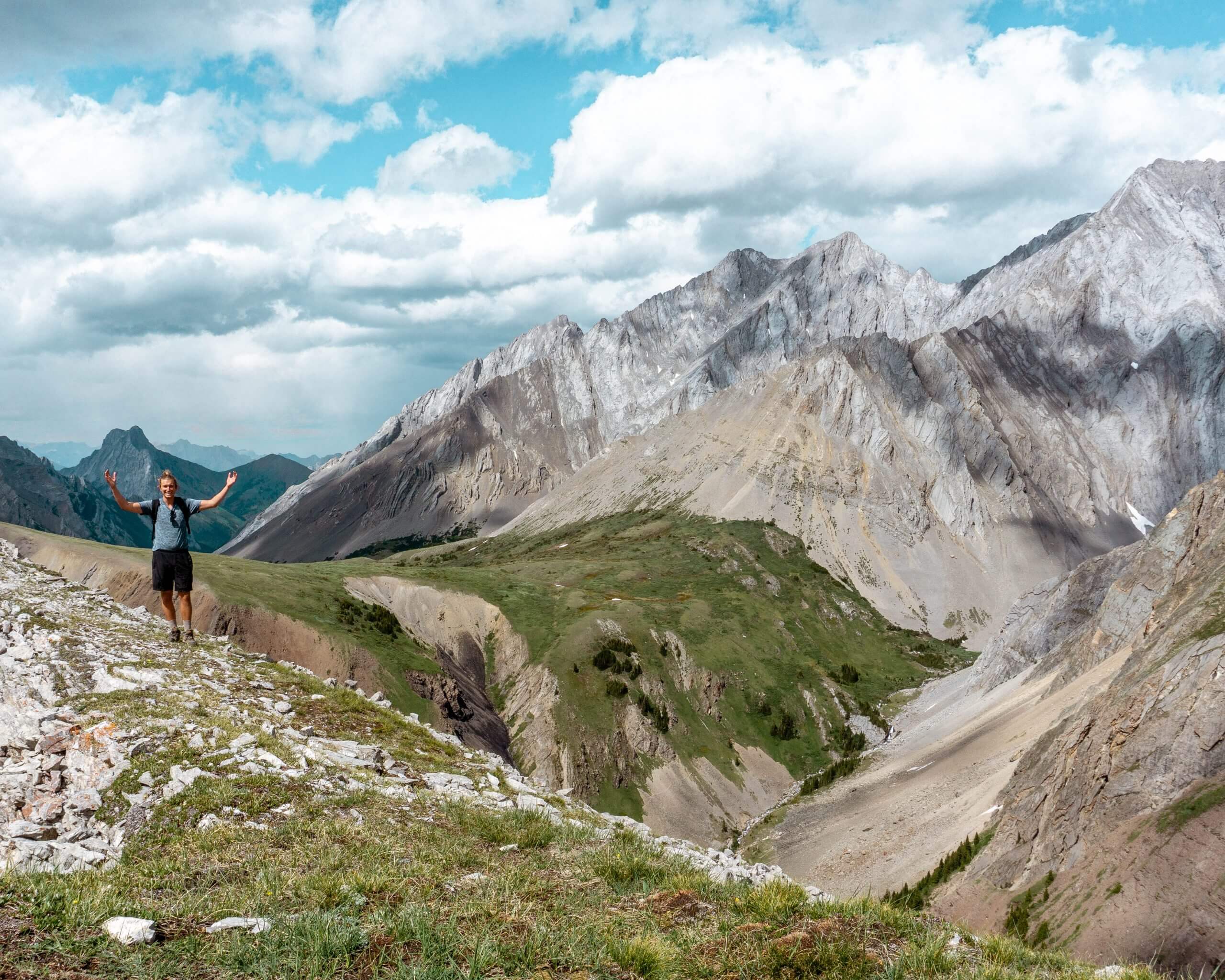
It does end up feeling like you’re on a rollercoaster by the end of it with all the ups and downs along the ridge line.
It was an absolute blast though and if you want more information on this hike then we got you covered.
Also read: How to Hike Wasootch Ridge in Kananaskis
#3 Grizzly Peak
Practical information about Grizzly Peak
Distance: 5.6 km return / 3.4 miles return
Elevation: 875 m / 2870 ft. elevation gain
Type: Out and back
Length: 3.5 – 5.5 hours return
Difficulty: Hard
Rating: 4 out of 5 stars
Here’s a map of the Grizzly Peak trailhead
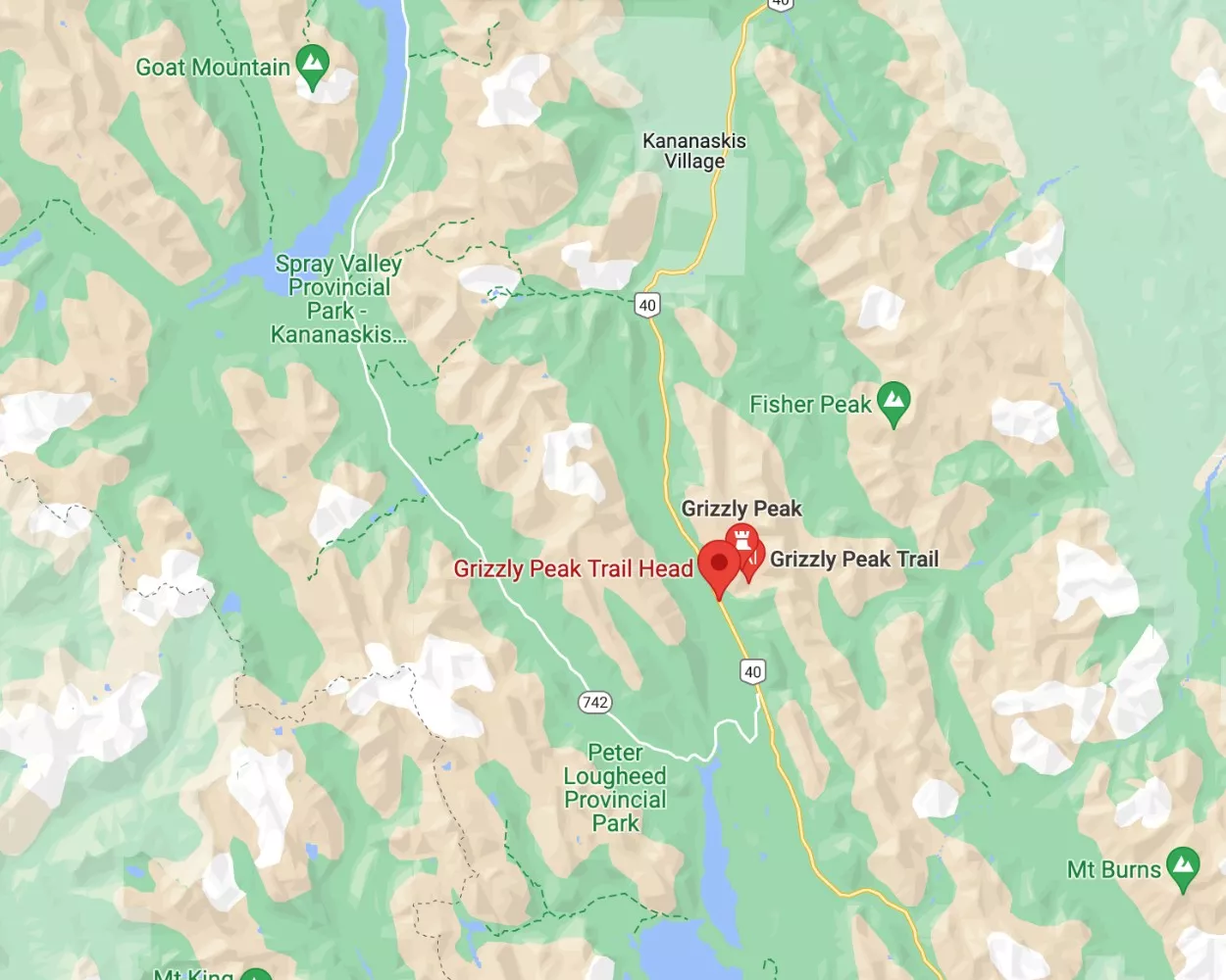
Grizzly Peak is a short but difficult hike in Kananaskis.
Located near Kananaskis and Peter Lougheed National Park in Alberta, you will find this mid-length hike in Kananaskis, an absolute grind that will test you both mentally and physically. But you’ll be so satisfied once you reach the top of Grizzly Peak.
If you truly are looking for a fairly short and difficult hike in the area then Grizzly Peak is a good option as the total hike is only 5.6 km / 3.7 miles return, but the elevation gain is almost 1000 meters.
It’s basically a steep incline the whole way up and a steep decline the whole way down. I mean, that sums up a lot of the hiking trails in Kananaskis but this one is a challenge, especially on your knees. A fantastic workout if you’re looking for that! 😉
It’s a fairly straightforward hike most of the way up as you can see the path the whole way.
Coming back down is a bit of a different story, so we would recommend trying to remember a few landmarks on your way up so you don’t get lost coming back down.
There are lots of animal tracks on this hike which you don’t notice going up, but coming down it gets quite confusing…
We had one of our scariest hiking memories on this hike. We simply couldn’t remember the trail back and ended up always having to backtrack and the sun was slowly starting to set and our cellphones were basically dead.
Luckily, after a minor panic attack we sat down for a second and thought about where we could have gone wrong and in the end made it down.
Please, don’t make the same mistake as us and either download the map beforehand, use AllTrails or take some pictures to help you remember the way down.
This also shows how important it is to be prepared and know where you’re going. Bringing a Satellite Communicator or beacon is a great way to stay safe in the mountains as well.
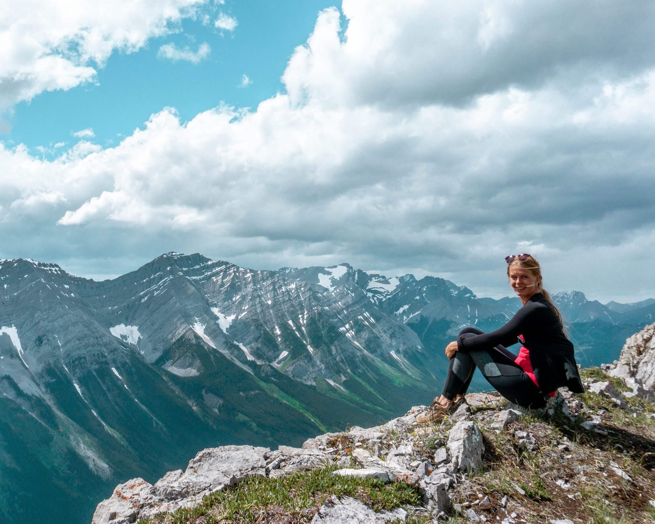
With all this said though, this is a beautiful hike in Kananaskis and if you go prepared you’ll have no problems getting to the peak.
It may be challenging but with a few breaks and a few stops for snacks, you’ll reach the top and have a 360 view of the Canadian Rockies.
Also read: Grizzly Peak – Quick and Challenging Day Hike in Kananaskis
#4 Jumpingpound Summit Trail
Practical information about Jumpingpound Summit Trail
Distance: 6.91km return / 4.29 miles return
Elevation: 438 m / 1437 ft. elevation gain
Type: Out and back
Length: 2 – 3 hours return
Difficulty: Moderate hike with a lot of incline
Rating: 4 out of 5 stars
Here’s a map of the Jumpingpound Summit Trailhead
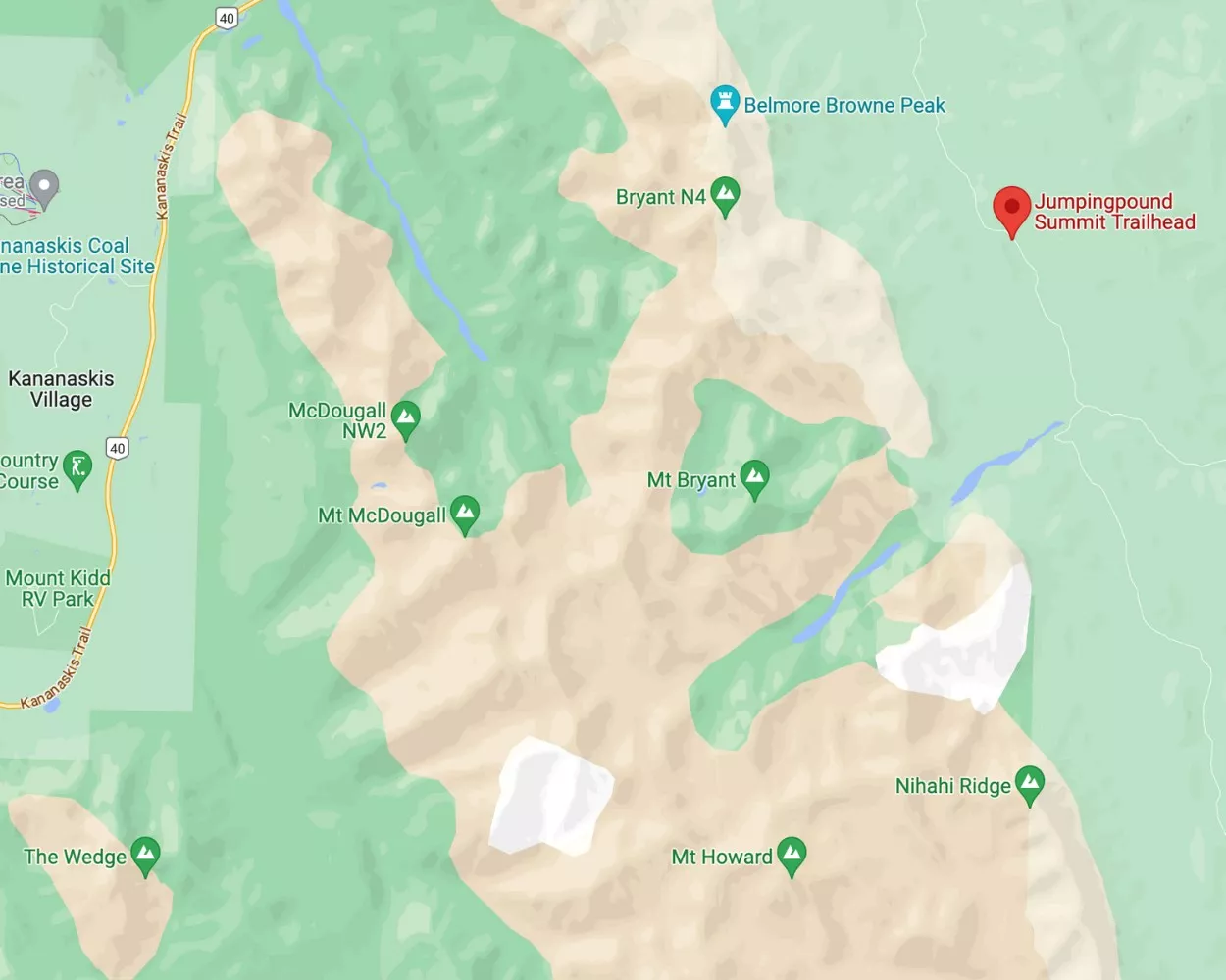
Jumpingpound is a gorgeous hike located near Bragg Creek on the edge of the Rockies.
If you’re coming from Calgary or somewhere east of the Rockies and are looking at getting your first taste of a hike on the edge of the prairies then this is the one.
Jumpingpound Summit Trail is only an hour and a half away from Calgary, so this one is an easy one to get to if you’re looking for a hike in Kananaskis.
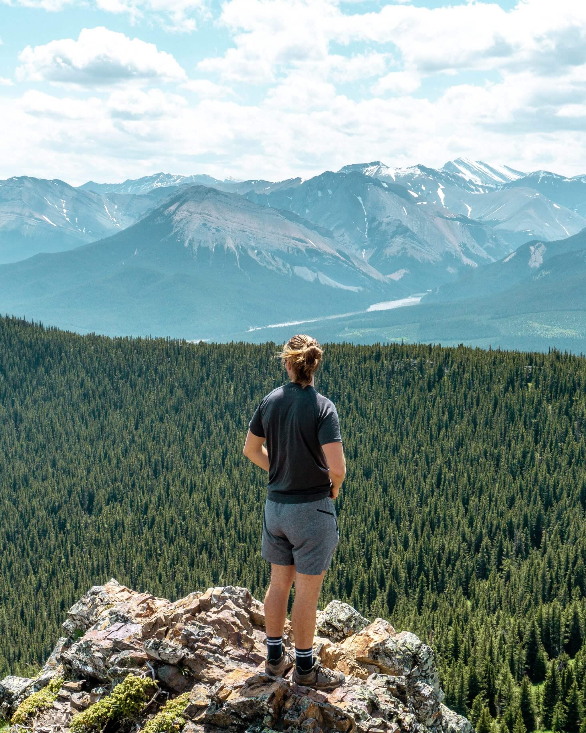
Jumpingpound is a great moderate hike that takes a few hours and is very rewarding with its incredible views.
The trail is great and so is the distance and elevation gain. It was a very nice peaceful hike that beautifully portrays the Rockies and just how huge they are.
You’ll be able to compare the prairies on the one side to the mountains on the other and get a feel for just how big they really are. It’s one of the many perks of hiking near Bragg Creek.

In case this isn’t a long enough hike we have this epic post on 3 hikes near Bragg Creek that can easily be done in a day.
We did all three in an afternoon and it made for a wonderful day trip from Calgary. We were so pleased with the waterfalls, pond, and of course the view from the Summit of Jumpingpound.
A good portion of this hike is spent in the trees, so the views aren’t there right away but as soon as you get into the opening you’ll be rewarded with mountain flowers and the summit not too far away.
We spent some time enjoying the summit and taking pictures.
There are even plenty of other trails and ridges that you can walk on once you’re at the summit of Jumpingpound. Either way whatever you decide this is a great moderate hike in Kananaskis.
Also read: Hiking Jumpingpound Summit Trail Near Bragg Creek
#5 Tombstone Campground Trail
Practical information about Tombstone Campground Trail
Distance: 20.8 km return / 12.92 miles return
Elevation: 479 meters / 1571 ft. elevation gain
Type: In and out
Length: 7 – 8 hours including time for lunch and pictures
Difficulty: Moderate to hard
Rating: 4.5 out of 5 stars
Here’s a map of the Tombstone Campground Trail
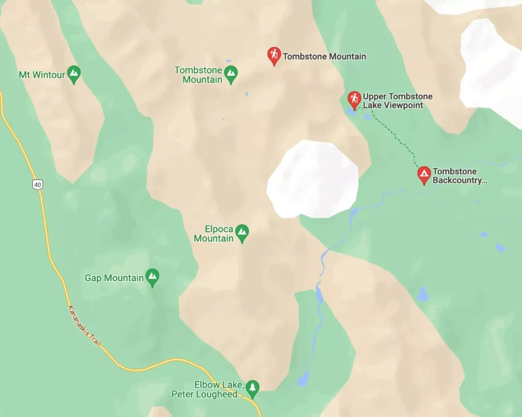
The trail starts at the Elbow Lake parking lot in Kananaskis (very close to Grizzly Peak actually!).
The parking lot will likely be super busy since it’s a very popular place to hike in Kananaskis. With tons of hiking, mountain biking, and even camping in the area it makes it a popular place for many Albertans and travellers to visit.

As this is a longer hike, we have divided it into sections: From the trailhead to Elbow Lake, Elbow Pass Lake to the valley along the Piper Pass Trail, from the Valley to Tombstone Campground, and lastly, from Tombstone Campground and back to the trailhead.
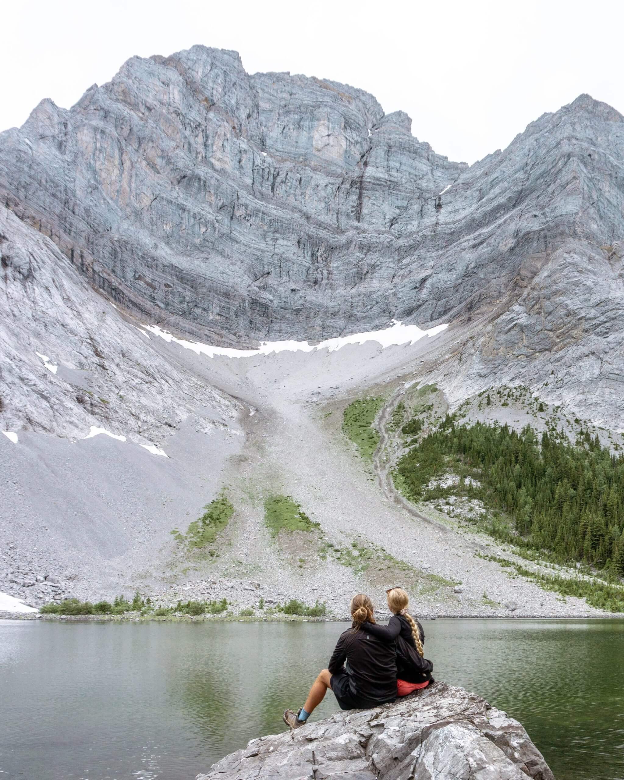
The hike to Tombstone Campground is a long one but you’ll pass an alpine lake, one of the most beautiful meadows in Kananaskis.
On top of that, if you’re feeling up for it, you can continue past Tombstone Campground and find two more lakes nestled under Tombstone Mountain.
You’ll likely have them all to yourself because it’s quite a journey to get there. Well worth it though- the pictures and memories made up for the sore legs!
Also read: Tombstone Campground Hike – Stunning Alpine Lake in Kananaskis
#6 Barrier Lake trail up to Yates Mountain

Practical information about Yates Mountain Lookout
Distance: 15.4 km return / 9.57 miles return
Elevation: 905 m / 2967 ft. elevation gain
Type: Lollipop trail (basically a loop trail)
Length: 5-6 hours return (including breaks)
Difficulty: Hard
Rating: 4 out of 5 stars
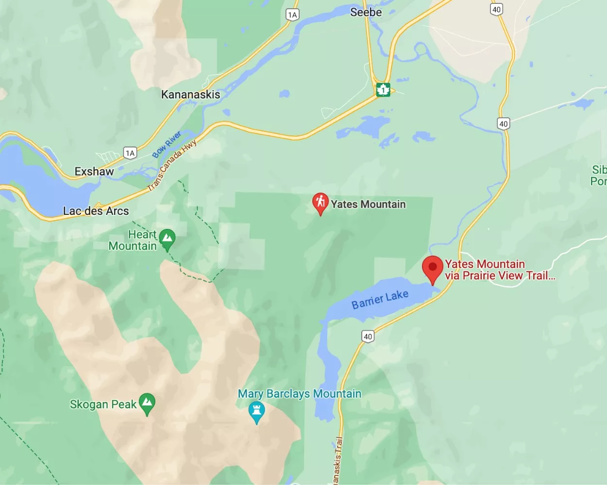
Here’s a map of the Yates Mountain trailhead
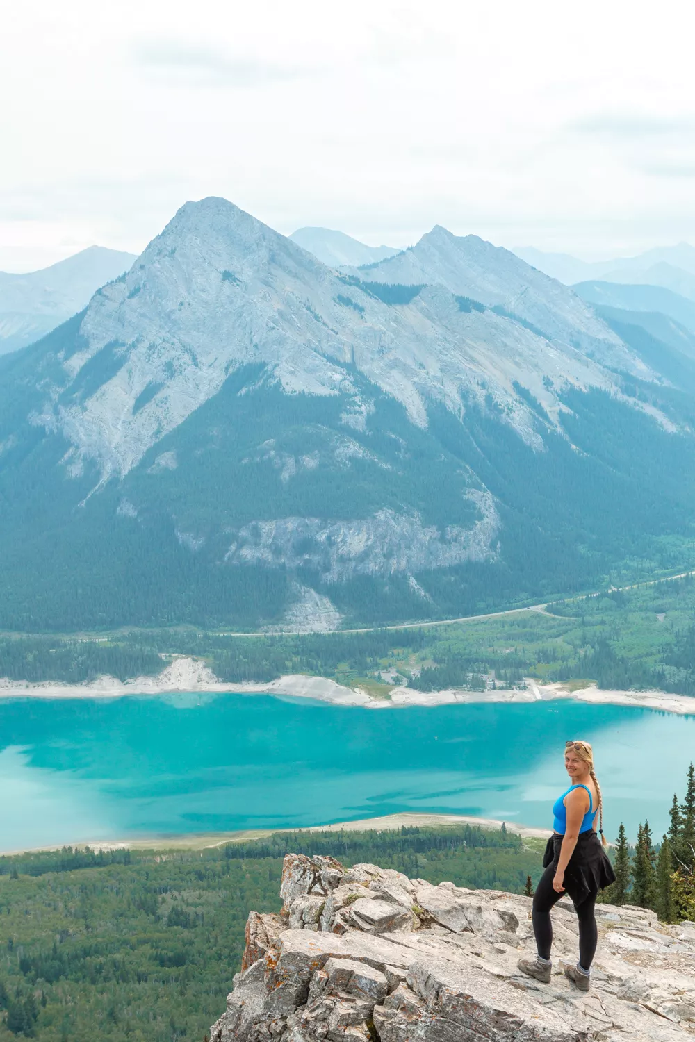
If you’re looking for one of the easiest summit hikes in Kananaskis, Yates Mountain is your hike.
The hike also starts right at the Barrier Lake Picnic Area so it’s conveniently located if you’re looking for a hike at the beginning of the Canadian Rockies.
On the way up to the Yates Mountain Lookout you’ll come across some awesome views of Barrier Lake which is one of the most incredible views.

If you love summits and maybe looking for a more relaxed summit without any scrambled Yates Mountain is also a good one for that.
There is a lot of elevation and plenty of switchbacks but there is no crazy ascent to the summit or anything like that.
In this post about Yates Mountain, you can see the approach up to the top. There’s even a fire lookout at the summit.
If you’re lucky you may get a chance to talk to the person who lives there and makes sure fires are spotted as soon as they start.
But it really is one of our favourite hikes in Kananaskis. There are quite a few different ways to go up and down to the summit so make sure to do some research before!
We hope you love this hike as much as we did! It’s also perfect for the whole family to do if they’re in decent shape. Or if you’re looking for a challenging but not crazy hike to a summit!
Also read: How to Hike up to Yates Mountain Lookout from Barrier Lake
More information about hiking in Kananaskis
Leave no trace
When you go hiking (and do other outdoor adventure activities), always remember to follow the 7 principles of leaving no trace.
This means:
- Plan ahead and prepare.
- Travel and camp on durable surfaces.
- Dispose of waste properly.
- Leave what you find.
- Minimize campfire impacts.
- Respect wildlife.
- Be considerate of others.
Hiking Tip: Look up the trail on AllTrails before starting your hike 🗺️. You can find important trail information such as recent wildlife sights and trail closures. Check out the free version here or get a 7-day free trial of AllTrails+ here.
Be bear aware
When hiking in bear territory, you can take specific precautions to minimize the likelihood of a bear encounter.
Bears typically have no interest in encountering humans, so by implementing these proactive measures, you can significantly reduce the chances of encountering them.
Some of the easiest precautions you can take are:
- Make noise and let the bears know you’re there.
- Be alert by paying attention to your surroundings and watching for signs of bear activities.
- Hike in groups of 4 or more whenever possible.
- Stay on designated trails.
- Check online to see if there’s been any recent bear activity in the area.
- Bring bear spray wherever you go. It’s your last line of defence and even though you hopefully never have to use it, it may just be the thing that saves your life. Make sure you know how to use bear spray as well before you go hiking.
If you ever see a bear in the wild, there are a few tips and things you should remember :
- Stay calm and slowly back away from where you saw the bear. Keep an eye on the bear but continue to walk backwards away from its territory.
- Start looking for a safe place to go. Try and get to another group of hikers. The bigger the group the better.
- Know that black bears and grizzly bears act differently so it’s important to identify what type of bear you’re seeing and then know how to act accordingly!!
Here is a great article from Parks Canada about bear safety, encounters, and attacks
You may also like…
- 3 Hikes Near Bragg Creek That Make an Epic Day Trip
- Tombstone Campground Hike – Stunning Alpine Lakes in Kananaskis
- Grizzly Peak – Quick and Challenging Day Hike in Alberta
- Black Rock Mountain – Remote Day Hike near Calgary
- Hiking Checklist
The best affordable camera for beginners

If you’re looking for the best and most affordable camera for beginners, check out the Sony Alpha a6000 Camera.
This is the camera we’ve been using for years and still use to this day.
It’s perfect for travelling and super easy to use – even if you’re a beginner.
Enjoy all the best hikes in Kananaskis
There you have it! 6 very different hikes in Kananaskis that we absolutely love and recommend.
These are all day hikes and can be done if you’re driving from Calgary, Canmore, or anywhere else that’s a few hours away from Kananaskis.
The majority of these hikes are good moderate hikes that will take an afternoon to do but there’s a few that are definitely all-day hikes.
Almost every hike in Kananaskis that we mentioned has an alternative shorter route so don’t pass up on a hike if it seems too long.
In our opinion, these are some of the best hikes in Kananaskis and we love being able to share this little pocket of the world with travellers and locals like you looking for some new hikes to conquer.
Let us know what you think about the list and what you think the best hike in Kananaskis is.
Stay safe in Kananaskis and remember the weather changes all the time so be prepared for all sorts of weather conditions.
📍 Love it? Save & share it!